 Hoosiers by the Numbers
Maps
Educational Attainment
Adults Ages 18 to 64 without a High School or High School Equivalency Diploma
- 2024
- 2023
- 2022
- 2021
- 2020
- 2019
- 2018
- 2017 (or interactive map)
- 2016
- 2015
- 2014 (multiple age groups)
- 2013
- 2012
- 2011
Labor Force Projections
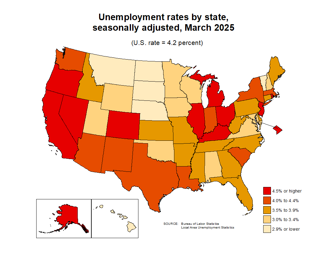
Local Area Unemployment Statistics (LAUS)
Thematic maps showing employment and unemployment by county and region.
States (seasonally adjusted)
Indiana Counties (not seasonally adjusted)
Informational Maps
- Balance of State Areas
- Indiana Counties
- Indiana Economic Growth Regions
Note: There are 11 economic growth regions (EGRs), but users will sometimes see Marion County extracted out of EGR 5 and displayed separately as EGR 12 due to its status as a stand-alone workforce development board.
- Indiana State Transportation Map - All Cities
- Regional Analysts
Quarterly Census of Employment & Wages
Related Links
- Boundary Maps (STATS Indiana)
- Thematic Maps (STATS Indiana)